
Why Your Carts Lock Up in the Wrong Places
The Lockout Fires in the Wrong Place. Here Is Why.
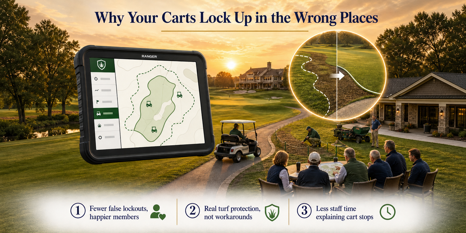
You draw a geofence around a sensitive area. A cart trips the lockout 20 feet before it gets there. Another cart rolls right through without triggering anything. Your ranger gets a complaint. Your turf takes a hit. And your staff spends the afternoon explaining to members why the cart stopped in the middle of the fairway.
This is not a software configuration problem. It is a physics problem. Standard GPS systems drift. The signal wanders 5 to 15 meters from the cart's actual position depending on satellite geometry, tree canopy, and atmospheric conditions. That wandering is random and continuous. You cannot tune it out.
When your geofencing system is built on a signal that moves 15 meters on its own, the boundary you drew on a map does not match the boundary the cart sees in the field. The system is working exactly as designed. The design just cannot hold a line.
What Drift Actually Looks Like on a Course Map
Picture a cart sitting still on the cart path next to the 7th green. Standard GPS puts that cart somewhere inside a 15-meter radius circle around its real position. Where inside that circle depends on the moment. It shifts constantly. The system is reporting a location, and that location is moving even when the cart is not.
Now draw a geofence around a newly seeded area adjacent to that green. If you draw it tight around the actual boundary, the drifting GPS signal will cross the line randomly, triggering lockouts when no cart is near the protected zone. It will also fail to trigger when a cart actually enters because the reported position might be outside the fence even as the physical cart is inside it.
Operators deal with this by adding buffer. They pull the geofence boundary back 15 to 20 meters from the actual turf they want to protect. That buffer absorbs the drift and makes the system behave predictably. It also means you are protecting a line that is 15 to 20 meters away from the line that matters. The turf between those two lines is unprotected.
The Buffer Is Not a Solution. It Is a Workaround.
Widening the buffer reduces false lockouts. It does not fix drift. The cart can still reach the edge of the sensitive area before the system reacts, because you had to move the fence back to make lockouts stop firing randomly.
This is a direct tradeoff. Tighten the fence to protect turf and you get constant false lockouts. Widen the fence to stop false lockouts and you lose turf protection. You cannot win inside a system that drifts 5 to 15 meters.
The only way out of that tradeoff is to change the measurement category entirely.
RTK Corrections Work Differently
RTK stands for real-time kinematic. It is a correction architecture, not just a more accurate GPS receiver. A fixed reference station on or near the course measures its own position continuously. It knows exactly where it is. When the satellite signals shift, the reference station detects that shift and broadcasts a correction to every cart on the network in real time.
The cart's receiver applies that correction before reporting its position. The result is a position accurate to 1 to 3 centimeters. That number does not drift. It is not a best-case figure under ideal conditions. It is the operating range of the correction system.
At 1 to 3 centimeters, you can draw a geofence on the actual boundary you want to enforce. Not 15 meters back from it. On it. The system fires when a cart crosses that line, not when the signal happens to wander across it.
What Zero-Buffer Geofencing Changes in the Field
When the position accuracy matches or exceeds the precision you need for a geofence, you stop needing buffers. That changes several things at once.
- False lockouts stop. The cart's reported position matches its real position. The fence fires when the cart crosses it, not before.
- Turf protection becomes real. You can fence a 10-foot buffer around a newly seeded collar and trust that the system will enforce it.
- Staff workload drops. Your team stops fielding complaints about carts stopping randomly. Rangers stop resetting locked carts in the wrong spots.
- Member experience improves. A cart that locks up where it is supposed to lock up makes sense to a player. A cart that locks up in the middle of a cart path with nothing nearby creates a service call.
Why This Problem Is Showing Up in Industry Conversations Now
The drift problem is not new. Operators have managed it with buffers for years. What is new is that the industry is now naming it explicitly. Cart manufacturers referencing inadvertent lockouts caused by GPS signal drift in geofenced areas are acknowledging in their own launch messaging that the standard system has a structural flaw.
That acknowledgment matters. When the equipment side of the industry starts describing drift as a problem worth solving, it confirms what operators on the ground already know. The workarounds they have been running are workarounds, not solutions.
RTK correction technology has been available in agriculture, construction, and survey for years at this accuracy level. Bringing it to a golf fleet is not theoretical. It is an engineering and integration problem that has been solved. The accuracy exists. The question is whether the platform running on your fleet is using it.
How to Know if Drift Is Your Problem
You do not need test equipment to diagnose this. Look at your lockout history. If carts are locking up consistently in spots that are not near any geofenced boundary, that is drift. If you have had to widen your geofence buffers multiple times to reduce complaints, that is drift. If your protected areas still take cart traffic because the system cannot hold a tight line, that is drift.
The signal is moving. The system is reporting it faithfully. The problem is what the system is built on.
What to Ask Any GPS Vendor
When you evaluate a cart GPS platform, ask one specific question: what is the horizontal position accuracy in meters under normal operating conditions, and is that accuracy maintained through an RTK correction network?
If the answer is expressed in meters rather than centimeters, the system is operating on standard GNSS. You will need buffers. The buffers will force you to choose between false lockouts and turf protection. That is the tradeoff you are already managing.
If the answer is 1 to 3 centimeters maintained through a real-time correction architecture, the tradeoff goes away. You can draw the fence where you need it and trust that it holds.
That is the difference between a GPS system and a precision GPS system. They are not the same measurement category.
The Practical Ask
If you are running wide buffers right now to manage false lockouts, pull up your geofence map and measure how far back your boundaries are from the turf you actually want to protect. That gap is the area you are leaving unprotected to make the system behave. That gap costs you turf.
Precision GPS at 1 to 3 centimeters closes that gap. The boundary sits where you draw it. The lockout fires when the cart crosses it. No buffer required.
Revolutionize Your Golf Operations with FAIRWAYiQ
Unlock the power of data analytics to optimize your golf course management